


Issued from CNRS and the Université de Lille, GRASP EARTH was created in order to democratize the access to high comprehensive air quality data.
We work around algorithms, computer tools, ground instruments and payloads developed by researchers in the field of Environmental Sciences, Earth Remote Sensing and Ground Instrument Engineering.
We invest our best efforts in keeping alive our scientific community, developing new coding approaches and shaping our own constellation. We aim to support green technology transition and assist decision-making in challenges of climate change, air quality and surface monitoring issues by providing an accurate characterization of Earth’s atmosphere and Surface.
.
.
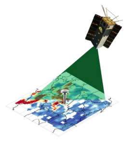
Thanks to the payload development carried out at NASA by Chief Technical Officer Dr. Vanderlei Martins and his team in Maryland, GRASP GAPMAP’s mission utilizes NASA’s HARP cubesat technology to launch the first commercial multi angular polarimeter (MAP) constellation into space.
MAP observations are presently considered as the most capable passive remote sensing observations for monitoring aerosol and particulate pollution. In this regard, GAPMAP missions mark a new step into Space history.
The constellation will permit 5 observations per day over each location at a global scale. A coverage that is not planned to be achieved by any current planned public MAP mission worldwide.
.
Developed over the years since the 90’s in the AERONET network project at NASA, our heart resides in the GRASP code.
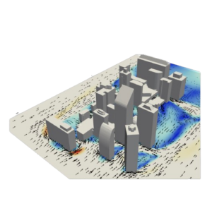
The algorithm works under different conditions, also including bright surfaces like deserts, where traditional aerosol algorithms struggle with the reflectance that overwhelms the signal of aerosols. It is a highly versatile algorithm that allows input from a wide variety of satellite and surface measurements.
In this regard, the company plans to bring a synergistic approach by capturing real time MAP data from space and merging it with ground data and public model data, in order to bring highly informative data on aerosol retrieval, cloud interaction and climate change issues.
GRASP EARTH is a scientific group made of physicists, engineers and developers, whose expertise focuses on the fields of Environmental Science and Remote Sensing.
With the support of institutions like EUMETSAT, CNES or ESA, GRASP’s synergistic scientific model will permit industries and regions to be on the same page regarding air quality ESG standards.
GRASP synergy characteristics will permit not only to add value in PM 1, PM 2.5 and PM 10 aerosol retrieval, but also in many other particle monitoring applications issued from natural phenomena, climate change, radiative forcing or cloud properties.
GRASP space and ground approach democratizes the use of advanced monitoring technology worldwide, permitting to better monitor, understand and act on emitting particles issues, for a prosperous air quality environment.